Further pictures of the Elrick Catchment and progress with the planned SUDS wetland will be added to the site as they become available.
If you have taken a picture in the area which you would like to add to the website, please e-mail it to info@3deevision.org with your own contact details, stating where and when it was taken.
Elrick Burn and Westhill Industrial Estate.
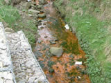
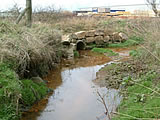
Elrick Burn classified as seriously polluted.
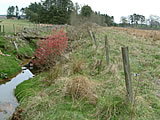
Elrick Burn and the site of the future wetland.
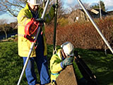
R&B Drainage consultants investigate the Westhill surface water sewerage system, to locate the areas contaminated by domestic sewage.
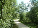
Picture from Arnhall Moss - courtesy of George Morrison.
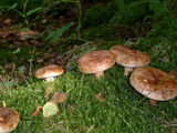
Picture from Arnhall Moss - courtesy of George Morrison.
 The James Hutton Institute