The Loch Davan sub-catchment lies approximately 50km west of Aberdeen. The sub-catchment covers an area of 3556ha of which the loch itself covers 31.1ha.
The landscape surrounding the loch has a complex geological history and is composed of various glacial landforms shaped mainly by erosion and deposition during periods of glaciation.
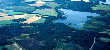
The sub-catchment had two distinct geographical areas, an upland area to the west and north dominated by heather moorland and forestry, and a lower lying area dominated by agriculture. The Logie Burn flows from the north, through upland moorland, forestry and agricultural land, into Loch Davan. Water from the loch flows into the Monandavan burn and then into the Davan Burn which meets the River Dee approximately 3km downstream of the loch.